Does the word that just popped into your head show up here? Find out:

Showing posts with label trail. Show all posts

01 August, 2012

Footstep Echoes

Not Nisqually, or even near Olympia, but you get the idea.

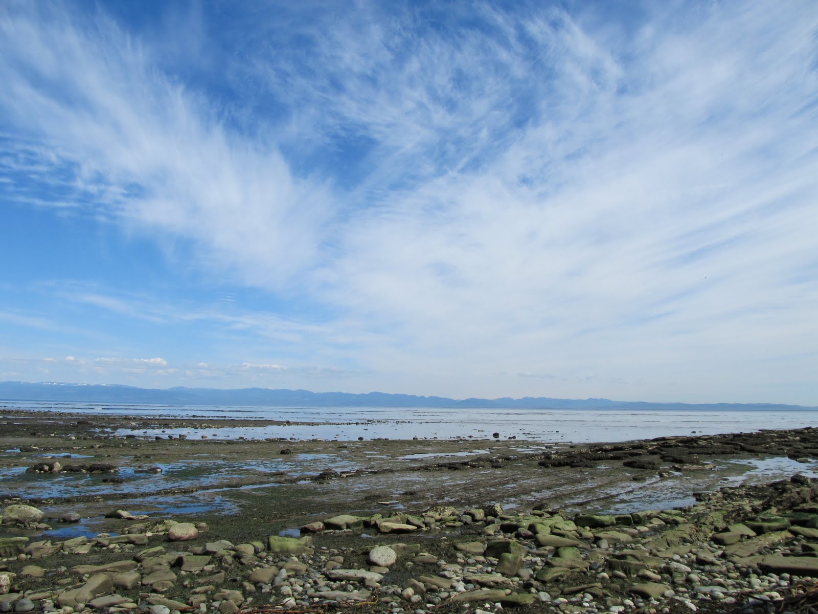
The girls and I have been enjoying Olympia on foot lately. We covered 4 miles on the Nisqually delta board walk, cold and windy, but rewarded with wildlife and a hot meal afterward. We ambled downtown (yes, humans can get places without cars), exploring neighborhoods and urban wildlife along the way to the farmers market, followed by a bus ride back (no, humans don't have to let the feet carry the load all the time). Forays through the neighborhood (sometimes with feet pushing pedals instead of pounding pavement) with no particular goal in mind. Motor-free missions to scope out firework viewing spots, or just to pick up a few things at the grocery. Walking down to the port to greet canoe-loads of tribal paddlers (ready to set foot on land after crossing Salish seas), and then trudging back uphill. Yesterday, we walked out on a beach as far as a very low tide would allow, our feet in water that does not hit new land til Asia.

We're exploring, finding where the cute puppies live and where the sweet fruit grows. We're getting places or going nowhere in particular. We're experiencing city grit and natural beauty. We're finding short cuts and long vistas. We're discovering secret gardens and re-discovering public places that exist only as blurs to the car-bound.

We're spending lots of time together with no screens, with no walls. Feet keep moving, and conversation flows. I was never a hiker, but this is familiar to me; it's in my blood. I remember walking through university woods with my family in search of blueberries and a Greek theater. I recall walking what seemed like a long way through the little town where my grandparents lived, visiting neighbors, the firehouse, and ending up at a soda fountain where we would watch our milkshakes take form. These things happened with lifelong teachers who appreciated the value of leaving classrooms and letting places teach at the pace of foot-falls.

As we walk, the earth is pressing memories into our feet. The kids may not remember any one sight, or a particular conversation that passed between us, but the ground was walked on by us, together, our feet shared places and soaked them up. (I enjoy walking solo, too, but moving as a small pack adds something.) Memories are being implanted in our soles, imprinted on our souls, nevermind whether our brains take note yet.

30 July, 2011

Backroads: Habitat

Mmmm. Shoulder verdure.
Roadless wilderness is a sublime thing...I've been told. Like most of you, I've never been that far from some sort of road. Maybe I have a pretty loose definition (re-arranged lines of 'a'a lava that would kill any car, 'Opihi Road on Moloka'i, Grays Harbor County ruts sporting alder just small enough to barrel through, tire tracks through pastures,...the list goes on), but still, I've rarely been more than a couple of miles from a motor vehicle trail of some kind. Old rail grades, rotten remnants of corduroy, routes traveled once by horses iron or meaty--maybe little more than a scar on the land now, but evidence of prior human traffic nonetheless. Sometimes these routes are harder to walk, much less drive, than the non-road nearby, but the point is that these are not pristine, wild places.

And yet, nature always reclaims them. Weeds sprout (rudely or restoratively so? depends on your perspective, or maybe your human hubris score) into the most heavily traveled roads in the nation. Even if the DOT crews manage to spray them, still the undersides and crevices and shoulders support spores and seeds and all manner of microbial life ready to start the reclamation process again.

Until there is a verdure. I've driven enough places poorly traveled to recognize the progression: forbs climbed by vines pierced by seedlings topped by a relentless future that tunnelizes the road before erasing it entirely. As long as the road is still maintained, the progression stops somewhere along that line, but on the back roads I spend so much time driving, it has begun, and stands poised to pounce. The day after construction, the artery begins to narrow. Some growth happens between tire tracks, but the real action is at the boundaries of this incursion, flanks subject to constant attack as nature abhors the biological vacuum of exposed subsoil or fresh gravel. Grading, mowing, chainsaw work all sweep it open to one degree or another, but in fact all back roads are terminal patients, and the further out they are, the more reliant they are on extensive life support.

Or from another angle, they return to life support. The early succession plants feed critters from mice to moose. Tribes used to burn their trails and other clearings in the forest for exactly this reason, to provide forage. Where can the four-leggeds find something to eat? Not in the dark understory of decades-old trees, but there's plenty along the road shoulder mowed last fall. Eventually, salal and salmonberry establish themselves, setting out a berry buffet. Roads tend to track in weeds, it is true, but this includes blackberry and other species that despite their alien-ness (and maybe egged on by their invasiveness) quickly establish themselves as abundant food source for native animals. On each shoulder lies a line of edge habitat, between the flat barren road and the forest or field or sage beyond is a strip of ecotone, often with resources not available outside it. There may be a ditch in a dry land, a berm raised above swamp, some anomaly that creatures will recognize and exploit.

These back roads, the more remote of which only see the occasional vehicle, have been adopted by some of the wildlife for travel as well. In a park where they know they are protected, you can see deer and elk making use of the open paths, pausing sometimes until cars come to a standstill, but in wilder places the animals generally yield the right of way, bounding off in that moment when they can hear your truck, but before you see them. Bears make heavy use of the roads, much easier traveling than having to haul those big bodies through the woods (not to mention the berry buffet, always a sure lure for the ursine).

I'm not an advocate for more roads. There are too many already, and it bums me out to see the number of newer roads failing to make use of older road beds, adding insult to injury, braiding ever broader impacts. Something about sitting up on a D-9 makes a guy want to cut new ground, not dress up something pioneered long ago. Pressure from environmentalists and the First People mean that a new road now may be less likely to be an ecological disaster than a new one 50 years ago, but they still become scars. Culverts clog and become landslides sometimes, ripping far larger gashes in the landscape. Sadly, some of these are built for a single use, from the wagon roads built by the army and abandoned all in a few 19th Century years to the ones still built for a timber harvest that won't be needed for another 80 years or so (at which time the dozer operator will scoff at the design and rip open a new one).

But it is also a mistake to plan as if this will stop. Or to believe that we humans are so powerful that we've permanently ruined a placed by driving into it. We drive back to our homes, and the plants grow, the animals traipse and browse. Nature cushions the blow, eventually makes the road something only an archaeologist would recognize. She shrugs it off, beginning with the shoulders.

27 May, 2011

Backroads: The Kelp Highway

On the Kelp Way in Clallam County, looking over at Vancouver Island.
How about instead of a backroad, I follow the first road this time? The stream so main that it was traveled by the first people to head east into the Western Hemisphere. For most of my life, this was presumed to have been the Bering Land Bridge, the rim of Beringia, a tectonic plate where some dry land peeked up when glaciers borrowed the ocean's topmost fathoms. People followed game across the arc of dry land, and ended up in the New World, where they made big fluted spearpoints for the convenience of archaeologists, who would name them after the town of Clovis, named after the first King of the Franks, who never conquered anything within a few kilomiles of New Mexico. What these people called themselves, nobody knows, but it was probably the same as nearly every other culture that has had the sense to avoid citification: "People."


It does not much matter, since Clovis people came along after others. Earlier sites have emerged over the years, and though plenty of people argue against the 40,000 year old dates in Monte Verde, hardly anybody disputes that 15,000 or so (feel free to give or take on the order of a millenium or two) is OK. In the old days, this was a problem because the period when the land Beridge was exposed was later. But now we know that people lived here before they could walk here. It already looks ridiculous and bigoted to espouse such an utterly baseless theory as "People could not get here except on foot. The land route was not available until 11,000 years ago. Ergo the hemisphere was settled after 11,000 years ago. Oh, and aren't these spearpoints cool?"


Sure, Clovis points are cool, but you know what's cooler? This:


This is an older type of point that has been found along the Pacific Coast. In the California islands, it was found along with a lot of bird bones, and is presumed to have been used for hunting them. The most common name for these is "crescent points," because they have that shape, sorta. What they look even more like is half of the bottom of a cowry shell, but the point is that they are every bit as beautiful as a Clovis point, and from a functional standpoint may be even more elegant (there are a bunch of Clovis points that would be useless for hunting, they are so big). 


The photo comes from an article here: Link

I don't know a lot more about this than you (maybe less), but the idea in that article and elsewhere, that the people who made these artifacts settled the New World by boat, is hard to resist. Kelp grows continuously enough along the shores of the North Pacific that long open-water voyages are not necessary (also: not precluded) to get all the way to California. Kelp forests are incredibly rich in food, and their wave-dampening fronds offer canoe people the respite of smoother water. They offer access to shellfish clinging to rocks that would be extremely difficult and risky to get at on foot. They take People alongshore until they find a nice place to stop for a while. Or even stop forever, set up a village and stay. Even those People, however reluctant they may be to set out on a thousand mile trip, venture back into kelpy waters regularly for everything from the kelp itself to fish, birds, molluscs, pinnipeds, crustaceans, and all the other orders of life stacked in the deep larder of a kelp forest. 

Kelp Highway Off-Ramp.
Glaciers plan to return still more of the water they borrowed during the Pleistocene, and we can look forward to more drowned land. By the time we run out of petrochemicals, we may have difficulty walking between hills that have become islands. Kelp and kin will still be there, topography will become bathymetry, and the seaweeds will cling to it. Even if (OK, when) the big one hits, the Subduction Zone quake that drops pieces of crust deep below sea level, then kelp thallus will respond with prodigious growth; the kelp forest will just get taller, more fecund. If we adapt to reality, and don't insist on living by some back-asswards theory, we'll be alright too.


21 May, 2011

Ode to Backroads

Maybe the last road you'll ever take


In this blog, you may have noticed an obsession with backroads.

Long ago I took the off ramp from the freeway, began avoiding the arterial routes. I hate being in traffic's mainstream, locked into someone else's pace, breathing their exhaust. The primary road lacks soul and scenery except when the desire to move large volumes of vehicles from point A to point B cannot avoid traversing beautiful country (I-90 through Snoqualmie Pass, for instance), and even then there is always some better alternative (two lanes of Route 20 to the north, or of Route 12 to the south). Freeways aim to streamline and thus shed everything interesting, force everyone into the same rhythmless rate of travel, offer quirkless repetition of the same few gas stations and fast food places. Urban thoroughfares consist of a series of stoplights between which strips of stores and other concrete castings mark what was once a landscape as corporate occupied territory. Where mindless masses heed the realtors' idiotic mantra of "Location, location, location," pioneers with all their memory are pushed out, humans with their individuality are hidden somewhere behind facades, and even businesses grow less diverse and interesting. Top dollar rent, bottom feeder culture.


Maybe my penchant for backroads stems from something simpler, though, and all of the above (and more, believe me, there's much more to that rant) is just rantionalization of a more basic desire to avoid traffic. 

Over the years, many of my best friends have been the same, people who will take longer to reach a destination if it means avoiding highways and main streets. Humans who crave green roadsides. Apes with an appreciation for the offbeat and historic. 


Back when I'd only driven for a few short years, I read Blue Highways by William Least Heat Moon. Already a lover of backroads, I cannot say it influenced me as much as the book and my internal narrative enjoyed a happy feedback, a harmony. It reinforced my belief that the road less traveled holds more promise of adventure and discovery, of meditation and discovery.


Over more years, backroads driving has become more than just a personal preference. Curving roads cannot be driven too fast, and in slowness there is more opportunity to see the lay of the land: terrain, vegetation, and old human haunts emerge in a way speed will not allow. As a student of cultural landscapes, there is no replacement for this kind of recon. The capillary network of small and semi-forgotten transportation penetrates most of the country and its history. What seem to most of my contemporaries to be roads to nowhere often go to a place that once was somewhere, to the old timer with a trove of memory or the ruins of where that memory settled into the earth.


So I take the lesser tine at the fork in the road, and follow. Sometimes this is history thrown into reverse: the old game trail that became and Indian Trail that became a road, then was bypassed and became less useful, less used, and abandoned. Shoulders shrug away to nothing, two lanes become one, pavement grows leprotic and patchy, and eventually fades to gravel, to mud-ruts. Trees arch over, salmonberry and blackberry crowds the lane, scratching the sides of the rare truck that enters with all the fervor and skill of a beginning violin student. Eventually, you come to the point where the plants just grown in the road, or maybe to the washed out bridge or dug up road where further travel must be on foot.

On lucky days, this means a 3-point turn (maybe 5 or 7), but other times the road ends with no wide spot, just dropping into a ditch or swamp. Then comes the slow back-up, trying to see the road behind through dusty windows and cockeyed mirrors. Either way can scrape the nerves like the brush scrapes the truck. Slipping off a narrow logging road leaves you in one of several predicaments: praying that enough wheels have traction to drive out, high-centered and figuring out if the winch can save you, a long walk out musing over ways to avoid ignominy among peers, or a quick and accelerating tumble down the mountain. None is pretty, but most are not deadly. It may take hours to walk out to find help, and this never happens in areas where your cell phone will work.


A different danger is getting stuck because someone blocks you in, parking in front of a gate you'd locked behind you. Sometimes, in quest of something, I've driven through an open gate, risking being locked in. Passing such portals carries some risk, maybe some thrill. The ones I tend to avoid either have evidence of heavy ongoing use (running into a gravel or logging truck barreling down and not expecting to see me is not something I want), or that have no trespassing signs, especially the home made ones, complete with promises of shooting.


There is a dark side to some back roads. Residents may be friendly, or they may live there because they do not want to be found--fugitives and recluses eye the passerby with suspicion, with one hand resting on a gun. The lone lost traveler may get help, or may disappear after a short exchange has established that nobody else knows where they are. Last week I drove a road that set my skin to crawling, my mind wandered to a Puna road that looked like this but for the lack of red cinders, a road where a girl was raped and killed because she thought a lone bike ride would be fun, but happened through the turf of meth-smoking animals who thought it would be fun to run her down. 


Nothing bad happened to me, and it rarely does on backroads. The isolation of back roads just lends itself to musings that can turn dark and paranoid under the wrong circumstances. Just as easily, though, you may come around a bend and see epiphany, or at least some interesting wildlife. Lots of times, I've seen a bear helping himself to salmonberries colonizing old logging roads, or come out of the woods and into a vista, or found a road on no map that leads to exactly where I want to go.


Meanwhile, some schmuck is tied up in traffic. There are people who never venture of the beaten, paved, and strip-malled path. I feel sorry for them, but not enough to want them out on the fine web of rural roads that I mostly enjoy alone. Too many people, and I'd have to give up some of the traveling habits that make backroads so much fun. No slowing down in the middle of the road to snap a photo, or outright parking there to poke around, knowing that nobody's coming. No peeing in privacy right out in the open. No foraging without giving away secrets. No, I am very happy that the main stream is where it is, and that poetry aside, almost nobody takes the road less traveled.

05 April, 2011

On Foot

Work is about 2.25 miles from where I live, which makes it walkable. Admittedly, this doesn't happen as much in the winter (unless there's snow, which I cannot resist), but now that temps are in the balmy upper 40's, and the rain is not as constant, feet will carry me to work more often. 


Some people set a brisk pace, and would cover the distance in a half hour or less, but my sense slow me down. Watching the pink and green haze of emergent buds causes the legs to swing slow (sweet chariot), maybe even stopping to zoom in and appreciate the unfurling beauty of a fiddlehead. My ears listen to try and find where the thrushes hide, their varied songs imitating creaky hinges and the slightly rusted spring of the old screen door that only opens when grandkids are in town. Nose gathers data: skunk cabbage beginning to emerge, air warming enough to carry the scent of awakening green.


Slower still as my foraging instinct kicks in. Pausing to fill grocery bags with tender young nettle shoots. Scoping the woods for bracken fiddleheads to browse. Noting where the Indian plums and cherries bloom in promise of future fruit. 


I was talking with an anthropologist who studies urban foragers in Seattle, and she said that foragers tend to be walkers. Cars go too fast and demand too much attention of the drivers; they can cover a lot of ground and maybe reveal some likely spots and the most obvious of the un-picked fruit trees. Same goes for the bus, although it has the advantage of letting riders look at the same spots over and over, noticing details after enough time. Bikes are more immediate, no windows in the way, able to slow and veer closer to a promising copse. But walking brings time to it's most human cadence, wandering begets wondering, daydreams played out and plans laid out. Details and discoveries appear to the lone biped that remain veiled to the wheeled.


I get to the destination slower than a driver. Getting to work takes about 40 minutes if I don't stop, compared to around 5 if I drive. Not counting parking and the walk from there to the building, traffic, and of course stopping to let pedestrians cross the road. On the other hand, I decompress and alleviate stress, get some exercise. 


Not driving saves me the cost of running a vehicle and buying gas, and relieves the atmosphere of having to absorb fossil fuel's farts. For a guy like me who doesn't subscribe to a religion, but still enjoys being self-righteous, walking is just the ticket: smile with the self-satisfaction of being green, glare at the cars that don't stop for pedestrians, stuff like that. And if I arrive home with a belly full of berries, maybe something extra for the table, or even just the peacefulness born of shedding work worries during an amble through woods and neighborhoods, so much the better.

16 February, 2011

Backroads: 14 Fog on the Columbia

Route 14 follows the Columbia along its north bank from near the mouth on up to the first big bend. How is a road following the Columbia River, one of the major arteries of North America, a back road? A road about a century old in its current path, laid down aside major rail lines even older, paving trails used by tribes since, as they say, "time immemorial," and before then by all manner of megafauna for whom time ended.

How? The interstate across the river in Oregon. I-84 is the choice of people who want to think that they are getting upriver fast, who feel slowed down when denied a choice of lanes, who want their travel tableau to be blurred and interdicted by semi trailers. More than once, people have looked at me with concern or pity when I say I'm taking Route 14 instead, asking if I know about the real highway across the river.


Last week I headed upriver on 14 from Vancouver, not at the mouth of the river, but in the tide's grip. On that day, nearly strangled in a fog. Up through Camas and Washougal, its white blanket interwoven with tendrils of pulp mill stink. But soon enough, winding through oak, gnarling dendritic silhouettes grasping handfuls of a cleaner fog, holding it to the earth.

My feelings on this are fuzzy. The fog can be cold and dreary, obscurationist curtailer of vistas, curtain shutting out the sun. Or it can be a coccoon, silken pod in which to meditate, swallower of clatter. I wrote about this then.

So popping up out of this into the sun could go either way. Freed from the drabness, exposed to the glare. Whatever. Nature carries on, regardless of whatever metaphor little humans want to paint onto it.


Beacon Rock and its trail (1777 steps to the top, last time I checked), wrapped in fog, is beautiful. From I-84 you can look across the river and see the rock, unless it's foggy and then all you see is guardrail.

Further up the river and into the day, the fog began to burn off. I got to see the end of it, lifting off the river, pushed down from the sun on top, thinning to a tongue, lick receding back down river, not wetting the sere plateau.

29 May, 2010

Backroads: 142


Riding river roads north from the Columbia's southern swing is to fight a flow of beauty washing into your every sense, inviting you to stop and gaze, dazed and amazed. Climbing the Klickitat on Washington 142 from Lyle to Goldendale on a green May day, especially with almost no other cars around to hurry you, can take a while.

The river ran hard that day, swollen with silt, foaming at the mouth of each eddy. Late wet snow feeding a good flow, lupines a-blooming and the hillsides not yet be-browned, summer's scorch safely at bay for a while yet. The oaks of Klickitat at that fleeting delicacy when the leaves are full but still soft and the bugs haven't really punched in.

Right of of Lyle, the valley gets pretty tight, and the lack of easy bottomland cut off sprawl before it could crawl upstream. 142 swoops along the bank. Meanwhile, and old rail grade has been reborn as the Klickitat Trail, which I  now yearn to walk, downhill like the river, but at an even slower pace to enjoy the bird and water songs, gaze at landscapes and pollinated bees.

The valley never becomes an expanse, but it does open up a bit about 10 miles in. The town of Klickitat is here, but I didn't stop. Wahkiacus gets a name on the map, but I don't remember a town--one of the great things about this road is that so much of it is unbuilt upon. 142 zigs and zags up through the kind of torn and shorn landscape you get when tectonics are at fault, and comes out addled enough to careen eastly when the main river heads north.

Somewhere around here, the road narrows to one lane, which is harrowing only on the frequent blind curves. If I hadn't been so blissful from the ride, I'd have worried that maybe I'd misread the map (or it had mislead me), and I was on a road that pinched out in the hills somewhere, but nah, there was no need for that. As with the rest of the run, the road remained smooth and solid, unfouled and practically untravelled.


The last big uphill run, a line skewing up and across, an engineer's straight edge mocking slope and contour alike, signals the end of the river road. Once you pop over the rim, the road spreads back out into two lanes and sticks to the grid laid down over a century ago in the aftermath of the Indian Wars by men moving to consolidate their Cartesian way. On the flats, the roads run north-south or east-west, maybe cutting corners where it suits. Blockhouse Butte (oddly enough, a hill with a strategic view of the plain) is the only natural feature that causes a ripple in this grid that continues to Goldendale.

Route 142 ends in that town, where it T's out at 97. After the thrill of running the gauntlet under the guns of Blockhouse (I've since learned, much to my disappointment, that the Butte no longer has gun emplacements, there is no Corporal Agar up there making frontier warfare hilarious), 142's magic kinda fades, and it just becomes the seam between fields that ends up in Goldendale. By that time, I was already fondly reminiscing on the banks of the Klickitat, under rustle of oakleaves and scent of Ponderosa.