Does the word that just popped into your head show up here? Find out:

27 January, 2014

Towers o Power

As Hawaiian Petroglyphs Foretold, These Forms Rise Above the Land

For whatever reason, this week offers multiple news stories about the risks of trainloads of oil, which brings up the risks of pipelines of oil, not to mention trainloads of coal. Transporting fossil energy, it turns out, requires the occasional sacrifice of life and lung.


Here in the Green Northwest, several of us have spoken out against trains and pipes full o petrochemicals crossing our turf, because we do not want to breathe the exhaust from Asians burning Occidental fossils, because we do not want to abet climate destruction, and because we are sometimes obstreperous. Meanwhile, our lands are criss-crossed by power lines originating from the not-yet-fossilized rivers where dams harness The Flow for our own energy needs, and harness the damned flow of salmon people and their human allies.

The path to this post
I've gone as far as to divest, to forsake fossil fuel, but that does not absolve me of the damage done by power lines and the fishes diced and birds sliced by dams and wind turbines. Dams don't blow up like a trainload o' crude, and turbines don't spew toxic clouds, but the power lines emanating from them speed up the invasion of thistle and blackberry into heretofore native ecologies, not to mention the arrivals of yahoomans who leave behind a trail of 4-wheeler ruts and garbage.

A hill just outside of Anytown, USA

Whether the web be of rails, or pipes, or copper, it has been joined in recent decades by another web of ether. Throughout the republic, eminences, peaks, knolls and knobs are topped by towers relaying sellphone cignals and who knows what else across the air.

It is hard to find a spot anymore where towers of power do not intrude on the landscape. It may sound superstitious, but it's hard to think of this and not recall the words of elders on some of the Hawaiian islands as they noted that something changed when electricity and poles arrived, that a richer (and sometimes scarier) night gave way to something more predictable, but less awesome and interesting. Outside of a very few areas (some of them, ironically, maintained by the same government so interested in snooping on everywhere else), it's impossible not to be in a grid traced by transmission towers wired and wirelessley knit together.

26 January, 2014

Hansville

Welcome to the Foxtrot Delta Alpha Hotel

Here's a shot from Hansville, by Norwegian Point. Close as the crow flies to Pugetopolis, but it feels a lot more remote standing there, buffeted by the wind.


Looking toward the water beyond the flock of shorebirds, there's Useless Bay (named for Ensign Ulysses F. Useless, fleet scapegoat of the Wilkes Expedition), then Whidbey Island, and then Mounts Baker, Shuksan, etc.

20 January, 2014

More Ice


In my last post, I forgot the bell-bottomed ice-cicles. Not far below the blobular clusters, these stalacticicles dripped from overhanging moss to the stream,...only to be swept away. The terminal drips knocked off again and again, each time a little bit splashed back up to the descending column. What should have tapered, flared.


Fluidity rushing by beneath, while gravitational accretional forms try to grow longer, but only get fatter. Not great photos, and even if they were, not the most amazing of natural phenomena, but I like 'em, and they do not reveal themselves in many of the places where people congregate, so they are all the more special.

Lili's remix: heavily altered, but somehow more true.

18 January, 2014

Ice Zoom


From 50 miles away, glaciers may gleam, but ice's intricacy is expressed simply as a reflection of the underlying landscape and overlying light. This shot is from Paddle Park in Olympia, but a spate of recent fieldwork (yes, replacing culverts so fish can get through is a good thing; no, it would not be good to take out an archaeological site in the process) got me in the neighborhood of some pretty ice, expressing a few of its many moods.


A cool thing about frozen water is that sometimes you can glimpse the crystal structure on a pretty large scale, no magnification required. Here on this beaver pond, the freezing surface is only a few millimeters thick, but there are lines a couple of feet long, shooting out in all directions, weaving a web over the whole surface. Between the lines, smooth mirrors of the frozen stuff.


On another beaver pond, the glassy interstices were few. The whole surface was adorned with slivers and feathers of ice.


Meanwhile, by a stream, the spray of a small fall gets locked to a twig in blobular clusters. Not crystalline at all to the naked eye, more like ginseng roots or some other living thing.
 

14 January, 2014

Four Mountains

Tahoma, its lenticular cloud drifting inland.

Late Fall and Winter are not supposed to be prime viewing for Cascadian peaks, but a drive today during which I could see Rainier and St. Helens pretty well reminded me that I've been inordnately fortunate this season. Like the week befor Turkey Day, when I got this shot of Tahoma (aka Tacobud, aka Mount Rainier, aka several other Salish and Sahaptian names) from the north. Far to the north, zoomed way beyond the lens capabilty and into the low-end camera digi-zoom range. What the image lacks in resolution, it gains in poetry, with the whisp of peak-cloud above and the rolling Cascadian holls below.

Il Posteriori de Montana Santa Helena

A few days later, and many miles south, I snuck up behind Mount St. Helens (various native names, many of which amount to "smoking mountain") and got the shot above. As I recall (dimly), I was standing on the edge of a gravel quarry full of bullets and cartridges and garbage, but lift the lens above ground and shoot into the distance, and beauty repoaces ugliness in the memory of that day.


Not far away in distance or in time from the St. Helens shot, I was able to spot Mount Adams (ask the Yakama about the name, because I just don't know). This is the west side, more or less, and in November, it was still not so snow-covered as you might think on the brink of December. Snow was late this year, and no doubt it looks different now.


And finally, here's Hood (I'll let the Oregonians talk about their names for this one). Shot from the north or northwest, way across the Columbia. I have better photos of this, but it's not bad, and it's from that same week, it's the pick for this post.

These shots are from different perspectives in the space-time continuum. I've had what they call a "five mountain day," when I was high enought (strictly elevationally speaking) to see the peaks of five of the snowy Cascadian volcanoes from a single spot. Jefferson, Hood, Adams, St. Helens, and Rainier, viewed from Table Mountain above the Bonneville damn.

The regular Cascades seem high enough (thousands of feet higher than the Appalachian chain, which formed the pinnacles of my growing up years), but when you get to one of those peaks, and see these snowy monsters looming high, you begin to understand big mountains. Hawai`i Island has similarly large volcanoes, although the tropical clime robs (or disrobes?) the snow mantle of its awe-inspiring potential, and the full mass is hard to appreciate without being well out to sea. Even in Olympia, Tahoma looms large, even larger when you remind yourself that it is 50 miles away, but still imposes itself on the horizon of any clear day.

I am pretty sure that the closest I will ever get to these peaks are the flanks, and that most of my appreciation will be from a distance. There's no inner drive to conquer and avail myself of "summit" as a verb. But as long as there are clear days and cameras, I will pull over and take a minute to appreciate and take a photo for memory's sake.

09 January, 2014

Not-so-tiny Bubbles, in the Brine


The other day at high tide, I kept seeing little geysers of bubbles working their way to the surface. More so from the gravel than the mud, but not just emanating from the rocks, where you would expect the instices to harbor air until the relentless tide forced them to exhale. As if from a pod of tiny sub-benthic whales, a spout would appear, then peter out, only to appear somewhere else.


As a kid, growing up near swamps and lakes where turtles lurked--and not just harmless sliders sunning on logs, but big cooters waiting to snap off the supposedly worm-like toes of kid--someone in the pack would always identify bubbles as a big snapper. We'd tiptoe across fallen trees, but keep our fearful feet high and dry. Now, I'm more inclined to suspect decaying plants, farting, especially if it's a place where I happen to know that organic material was recently buried. Besides, any turtles caught in Puget Sound in January are not gonna be breathing.


The simplest explanation is that this was a really high tide, and when the ocean over-runs land, air makes it's way out of not just the interstitial spaces in gravel, but from burrows, worm-holes, old root channels, and all the other disorderliness that happens in the living soil.

Trouble focusing? It's not you, It's The Water.

The simplest explanation is often right, and no doubt it had something to do with all the tiny bubbles in the brine, escaping, amassing, and enlarging before drifting off on the ebb or effervescing into air. But leaning in for a closer look, another answer could be seen. Where bubbles rose, the water swirled, its transparency changed to a thousand warped tendrils. This is fresh water entering salt, rain that fell a day or month or decade ago coming to the surface. Any other day, this water would seep slowly, maybe even stick to itself just below surface, but with a half foot of saltier water above, fresh water joins the bubbles in an eruption. Eventually it mixes, helping the South Sound keep it's corner of the sea a low-salt haven. Ah,...sweet entropy.


08 January, 2014

The Highest Tide

Mission Creek, King Tide 2013

This past weekend, Puget Sound experienced the "King Tides," the highest tides of the year. According to the NOAA tide prediction tables, the Olympia Shoals station would reach 16.56 feet on Saturday, and 6/100ths lower on Sunday.

Olympia author Jim Lynch, it so happens, wrote a novel set here that he called "The Highest Tide." It's a great book, for many reasons. Way down the list for most people, but interesting to me, is how the titular event, a very high tide, fails to conform to predictions, but enlists a low pressure system and prodigious rainfall to flood above expectations. Something similar happened last year, when February's highs exceeded January's braggy "King" tides. Tides are set in motion by gravitational forces in our solar system, and as such are events that we can track with physics and math, but only to a certain precision, beyond which accidents of history hold sway.

Budd Inlet, 8:08 AM, January 4, 2013

This January, we were influenced by high pressure, and there had hardly been any rain at all, so maybe it was just a Jack Tide. Still, dozens of people showed up downtown, where they could see the floating docks at Percival Landing approach a horizontal state. Surely there are plenty of photos of downtown king tides online, among which I will point to these, because they show the nearly 20-foot rise that occurred between the midnight low (-2.99 ft) to the morning high (16.46 ft) on Friday.

The center of this shot is usually dry land.

My photos are from the mouth of Mission Creek, at the south end of Priest Point Park. I went there Saturday alone, and Sunday with the kids, and each time there were just a couple of other people. With the tide this high, the beach disappears, and a fair amount of the spit takes a dive. Last time the kind tides came round, they had to force their way through a culvert and into a silt-clogged former estuary. For many decades, that was how it went, a grand natural flow imprisoned in a 3-foot concrete pipe.

This time, the Salish Sea flowed free through a channel. This was because in 2013 the culvert was ripped out, the road berm damming (and damning) Mission Creek was dug up and hauled away, and a new channel was excavated. Designed by an engineer, and maybe not where the channel had been before it was covered, but the goal was restoration of the natural system, rather than creating space for real estate development or growing a crop that does not belong there. It is a well-intentioned fake.

As high tides sweep in and low tides flush out, the estuary may change. Silt once sequestered behind the buried sand spit will slither down into Budd Inlet, the channel may migrate, and the spits advance and retreat from either side. Critters will come in and explore the mud, and plant remains will hitch rides out on freshets and ebbs. The abrupt line of gravel laid out according to contract specifications may spread out and soften, or maybe the layer of bricks and rubble once buried by the modern beach will re-emerge. Who knows? It will be interesting to watch as the tides and other forces sculpt this work of man imitating a work of nature.

01 January, 2014

Obligatory New Year Post

The cycle continues

For Americans, this is the day of the New Year, an occasion to reflect and resolve, to mark the cycle's turn. In places where people did not dump the moon for a calendar solely solar, the New Year comes later. For me, the Winter Solstice is when one year clicks over to the next, and this Gregorian conceit that begins the new year a week and a half later means little.

But, it does come with a day off work, and therefore some time to write. Maybe also to reflect backward resolve forward.

The grimacing corpse of 2013
Looking back,...I'd rather not. The first year of the new Baktun (what? nobody wants to use the Mayan calendar now that it does not portend the End of Everything?), was not great. Coulda been worse, though, and I guess bad years just help make the other ones look good, and whatever dies becomes the soil for future fecundity. Not that I'm a relentlessly positive person, mind you; it's not as much "If life gives you lemons, make lemonade" as it is "If life dumps a load of shit at your door, make compost."

This year's run transmogrifies into a monster and fights itself to death, but also creates a new round of growth and life.
Looking forward,...I guess I'd rather not do that either, except in the most general way. I have no specific resolutions other than to continue trying to make the patch of earth I occupy a bit better. The compost should come in handy.

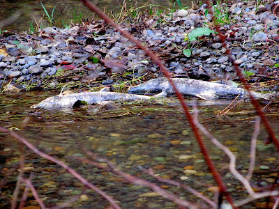
Ugh. All I really wanted to do today was post these photos of the 2013 chum salmon run on Kennedy Creek (photos date to a few weeks before the Solstice). Maybe I should have written nothing, instead of risking this maudlin run into a Message. Maybe I should just stop now and leave you with New Years Resolutions by Greg and Teddy Wayne (via McSweeney's):

  • 640 × 480
  • 800 × 600
  • 1024 × 768
  • Get into jazz

Happy New Year, whenever it begins.