 | |||||||
| Palus Country |
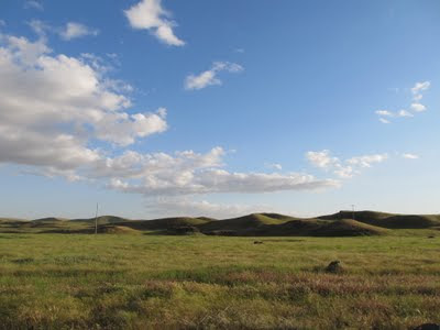
Driving the roads through Palus country--261, 127, Whoopem Up Hollow Road, and others--you experience the shifting lay of the land, the tricks or perception and perspective. Rolling hills cradle valleys flat with silt and sand and wiggling only sidewise, canyons reach deeper to find big rivers. The hills have a bag of tricks to hopelessly confuse the traveler who strays off the beaten path, and bewilder even those who don't. They come in all sizes, but the hilly region is vast, so you start to think they are all a little bit different, but mostly the same. Often, nothing else breaks the horizon to provide scale, and what appears to be another smallish hill may take much longer to drive up or around, prying loose your visual from temporal.
Even with my habitual crutches--maps of paper and ether, memories of the satellite view pored over early in the morning--I found it easy to get disoriented and to doubt myself. Though the terrain undulates wildly on the human scale, all but the most detailed topo cartography fails to capture it; maps flatten the country to a degree that they are nearly useless for recognizing any one hill. Only where there is a big butte or where water has sliced deep below the surrounding hills do the contour lines reveal much. Except for the Snake's coulee and canyon runs, the rivers and streams tend to be the only level terrain, serpentine as you fly over and look down, but generally with less vertical relief than the cottonwoods lining them as they meander through flat-bottomed valleys.
 |
| Rivers Snake Through It |
 |
| Inscrutable vermiform script crawls across the sky. Maybe prophets can read it. |
But for the most part, no wanderers roam the hills. Small roads wind among them, bigger roads shoot straight through. The Palouse is mercifully free of truly big roads, though, and even the main throughways like Route 12 are two lanes most of the way. The summer heat coaxes tar from them, and when the sun hits it just right, it shines. Mile after mile of squiggly lines, like Arabic writing under my tires--the moving car reads, and having read, moves on. Or maybe Tibetan script, my truck rolling over with it's prayer wheels.


No comments:
Post a Comment